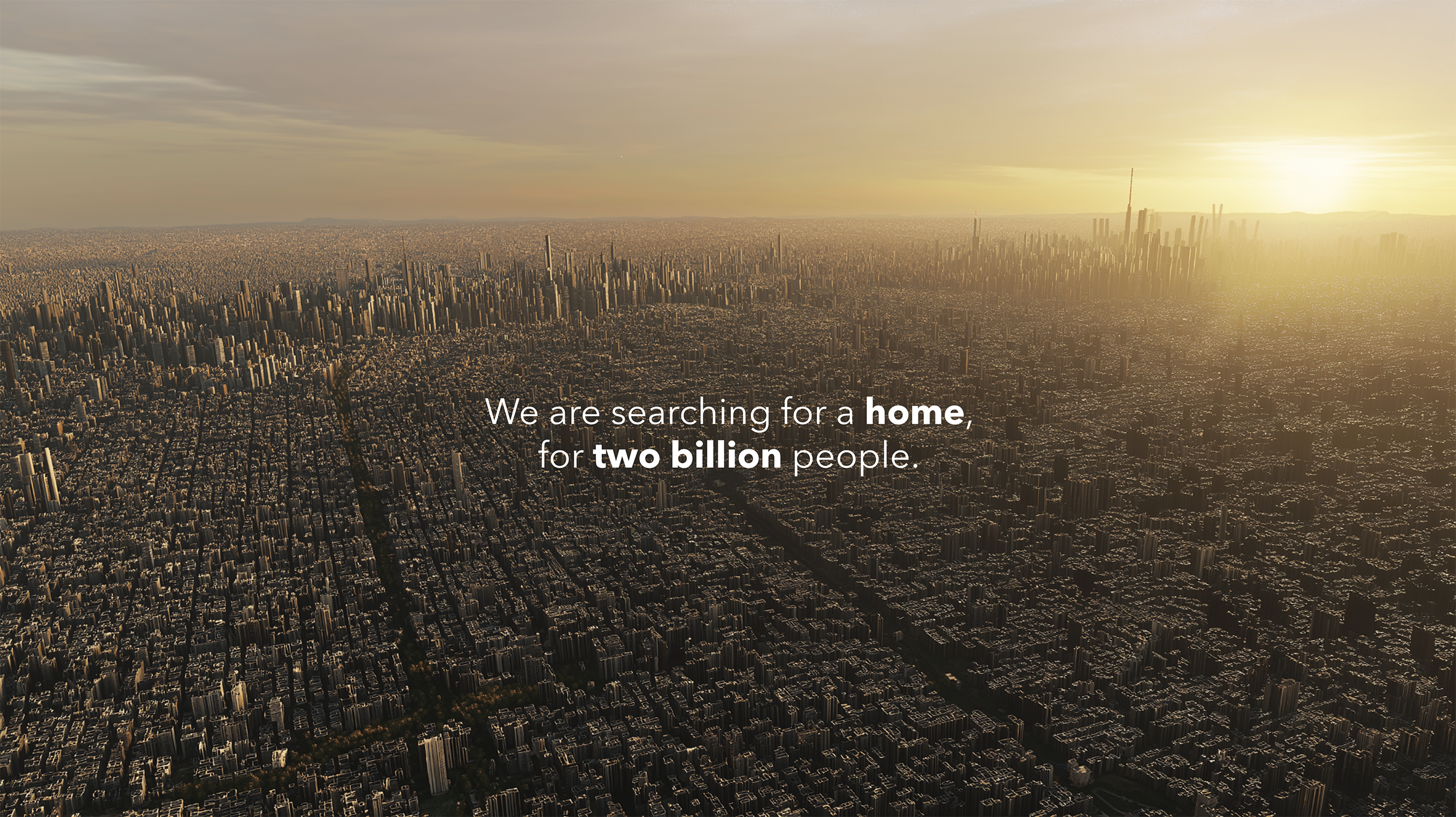



Or: The potential of digital model and AI driven simulations
in new approach to sustainable urbanism
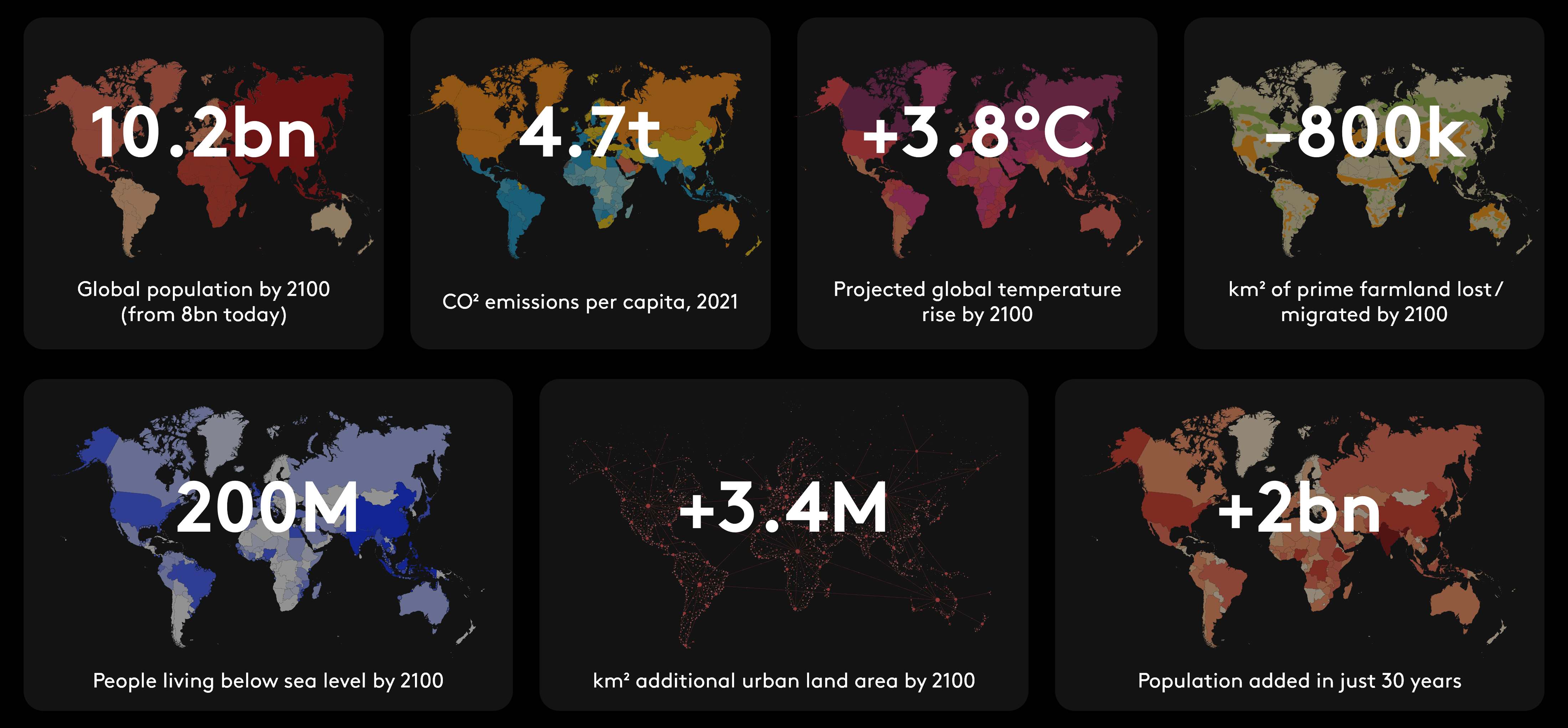
As urbanization continues to advance around the globe and the world’s population is projected to peak at 10.2 billion by the year 2100, traditional horizontal urban models are proving increasingly unsustainable. This paper proposes the High-Performance City and the linear urban system of Urban Strings as essential innovations in the field of urban planning. By combining the social cohesion of the village with the economic dynamism of the modern city in the form of „zero gravity urbanism“ this model utilizes three-dimensional mobility and thematic linear elements to create highly dense, vibrant environments that significantly reduce the global ecological footprint.
THE CLIMATE & POPULATION:
KEY 2100 PROJECTIONS
The Anthropocene Age is defined by humanity’s dominant impact on the planet, nearly all of Earth’s non-Antarctic land surface shows evidence of human-driven change. As the global population is expected to increase by two billion within the next few decades - primarily in Africa and Asia - the environmental stakes are critical. Current horizontal urban sprawl and open-field agriculture have created a structural ecological deficit. At the same time, humanity’s demand for natural resources, productive land and the absorption of carbon emissions exceeds the planet’s regenerative capacity. To mitigate climate-related risks, such as a projected temperature increase of 5.2°C and a rise in sea levels that will affect 200 million people, a radical shift in urban design is required.
The Evolution of Urban Typologies
Over recent centuries, advances in technology and society have seen human settlements evolve from small towns to modern metropolises. Each typology offers distinct benefits and drawbacks:
The Village: offers human scale, social cohesion, and proximity to nature, but lacks the diversity and growth capacity required for modern populations.
Urban Sprawl: characterized by a car-based design approach, this typology suffers from low density and poor walkability, resulting in highly inefficient land use.
The Modern City: provides density and economic opportunity but often suffers from sensory overload and social isolation, particularly at higher levels.
The current situation is defined by the coexistence of - rather than any evolution in - these models. The challenge lies in constructing a new urban framework that reorganizes their respective logics into a single operative system, while embedding nature and sustainability as intrinsic spatial and structural conditions.
THE HIGH PERFORMANCE CITY
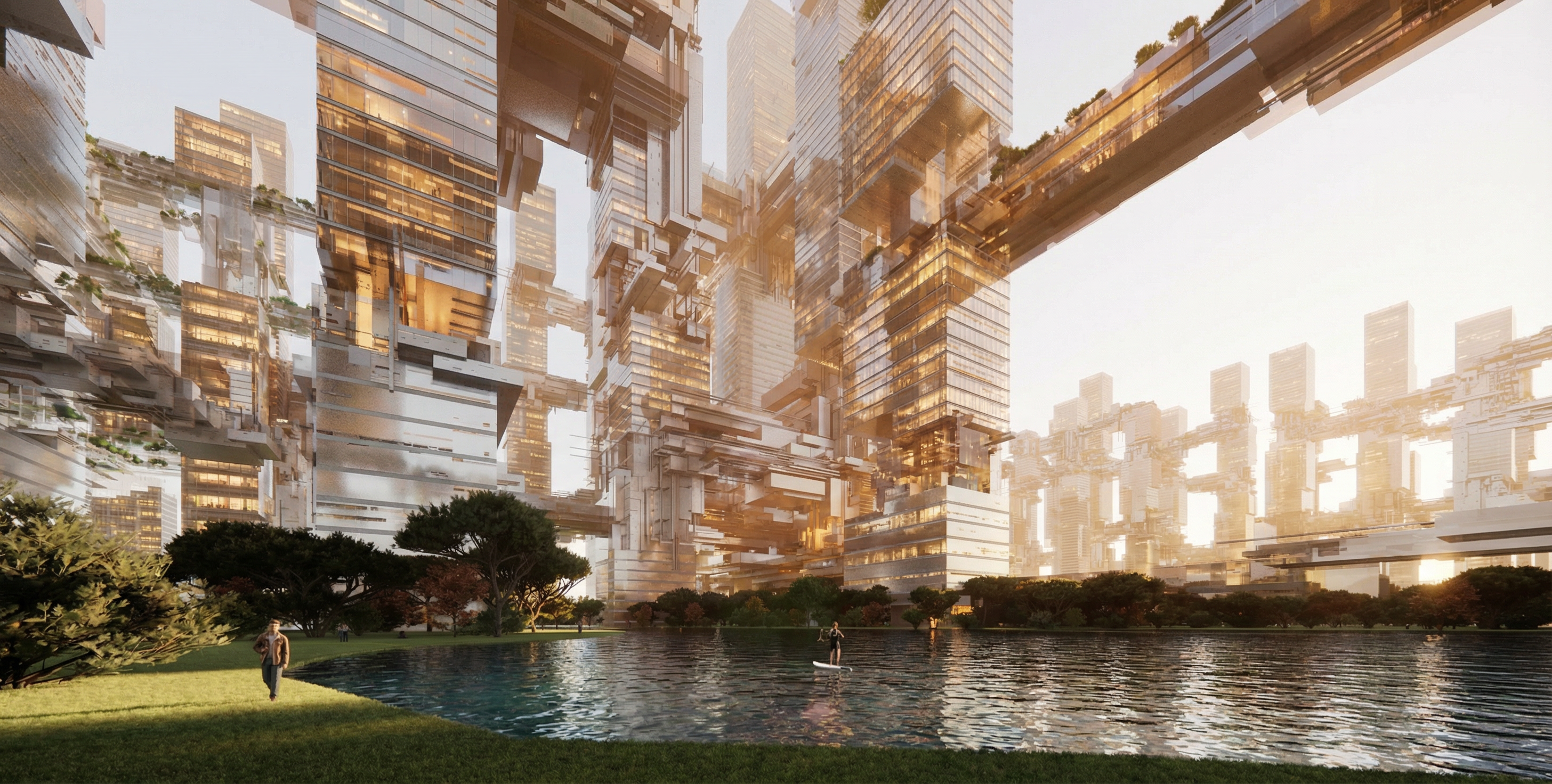
The High-Performance City proposes a new urban typology that combines village-like intimacy with the density of the contemporary metropolis. It is structured as a three-dimensional urban network that maintains proximity to nature while intensifying land use. Urban sprawl is not managed but replaced - through concentration - by a continuous, ecologically resilient urban field.
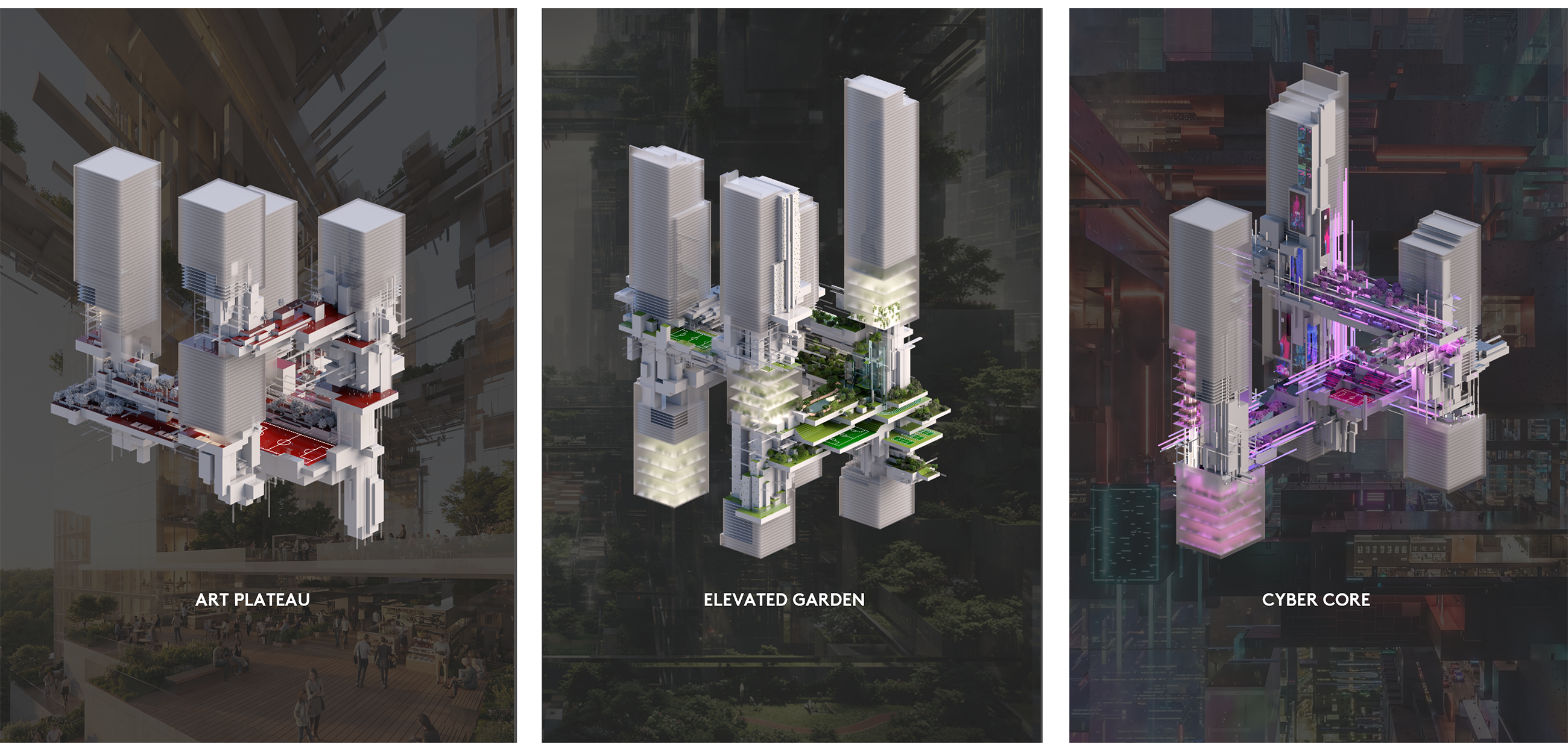
The system is organized through Strings: continuous urban corridors composed of clustered anchor functions such as hospitals, theaters, and universities. These Strings are not new entities but a reconfiguration of existing urban conditions. They operate across thematic fields - culture, retail/entertainment, education, health - that are already latent within contemporary cities.
By aligning these Strings with housing and infrastructure within a compact, three-dimensional walkable radius, the horizontal logic of expansion is removed. Previously sprawling urban fabric becomes redundant and can be decommissioned. In its place, land is released for ecological recovery and renaturalization, allowing local systems to reestablish themselves.
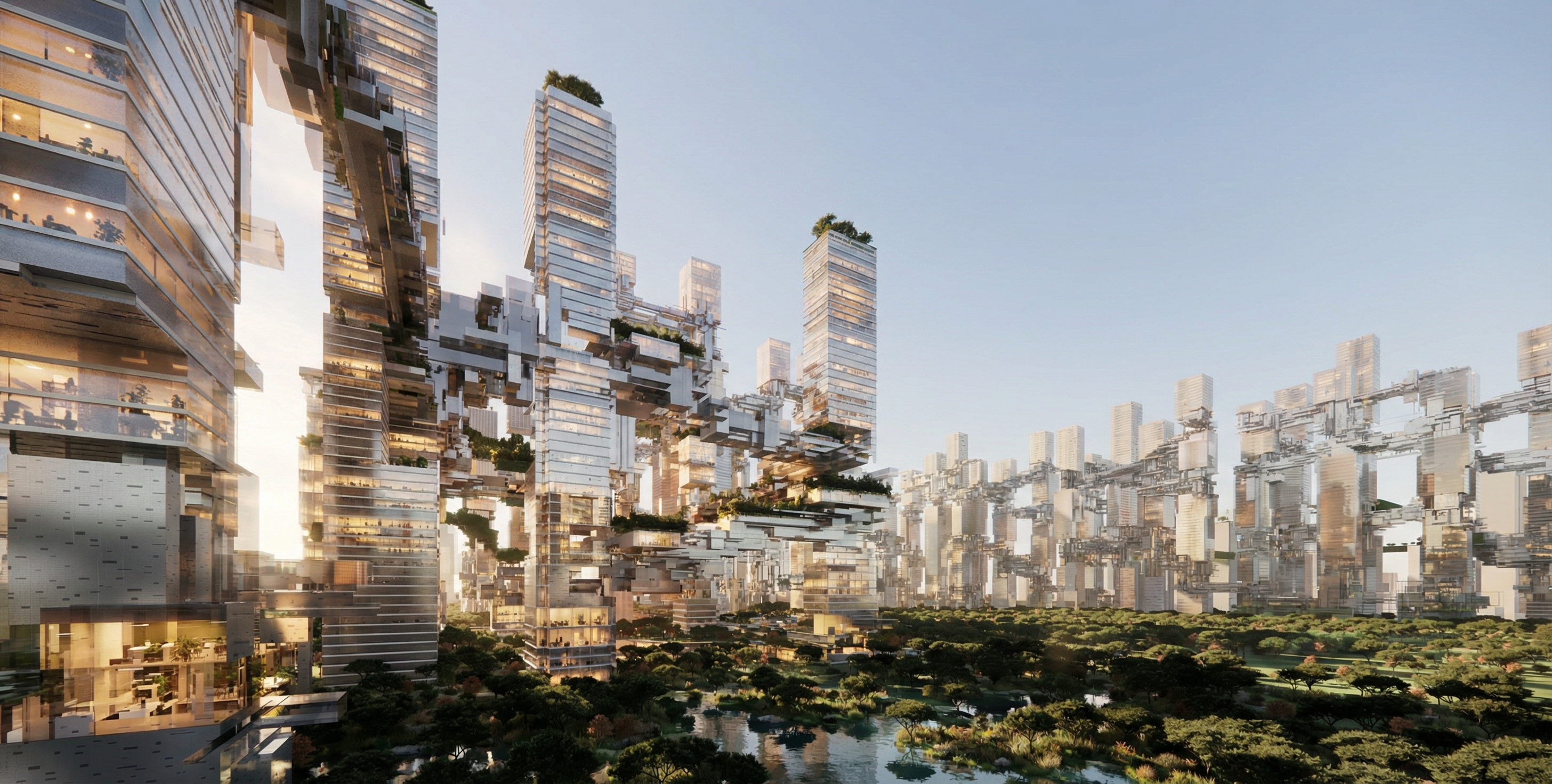
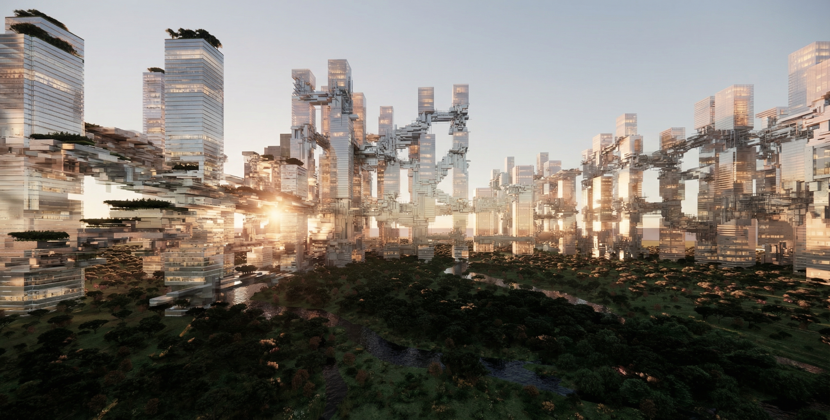
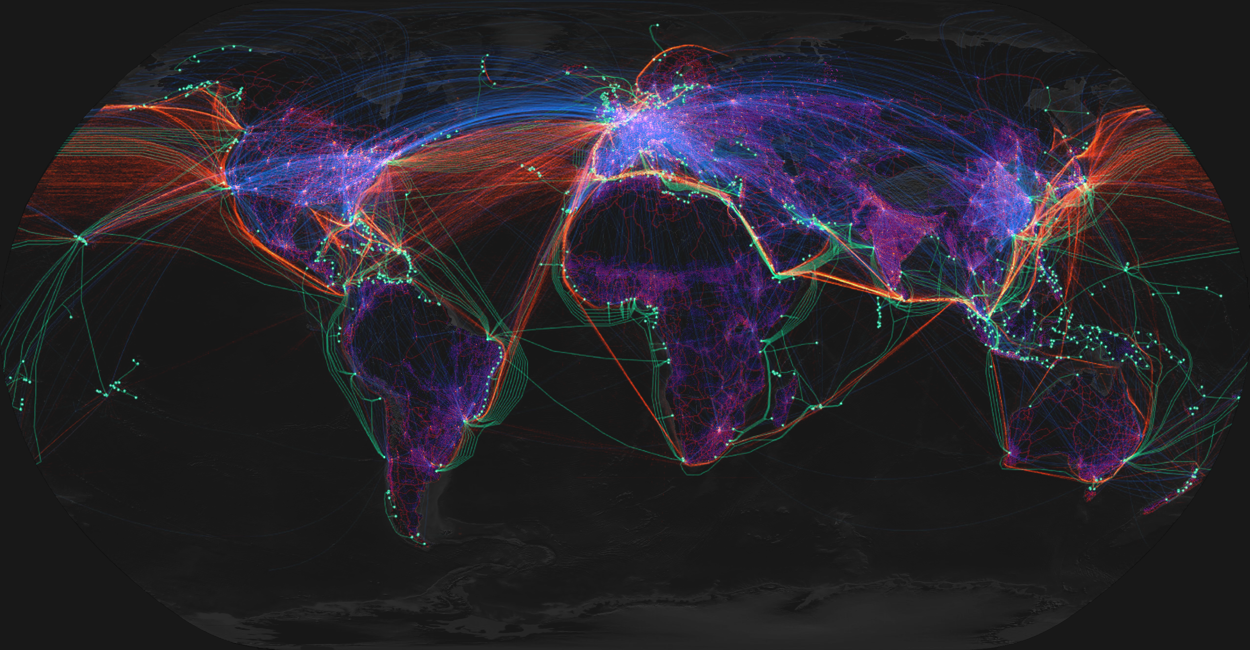
THE ANTHROPOCENE IS THE AGE IN WHICH HUMANITY HAS QUIETLY RESHAPED THE PLANET - SO THAT FROM AFAR EARTH STILL SEEMS WILD AND CONTINOUS, YET ON CLOSER VIEW ITS SURFACE IS THREADED WITH CITIES, ROADS AND INFRASTRUCTURES THAT REVEAL HOW DEEPLY WE HAVE REDRAWN ITS PATTERNS.
The Design Method
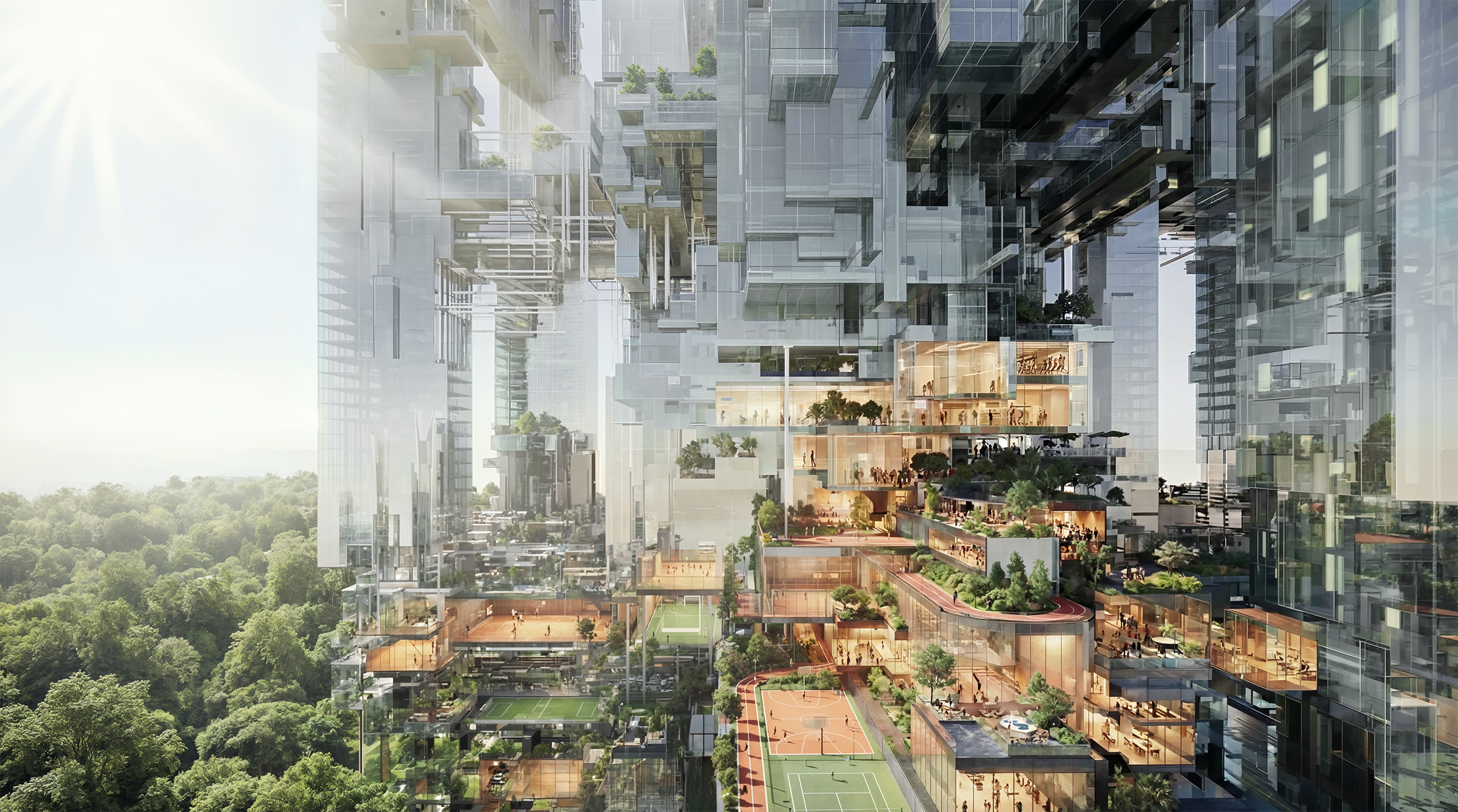
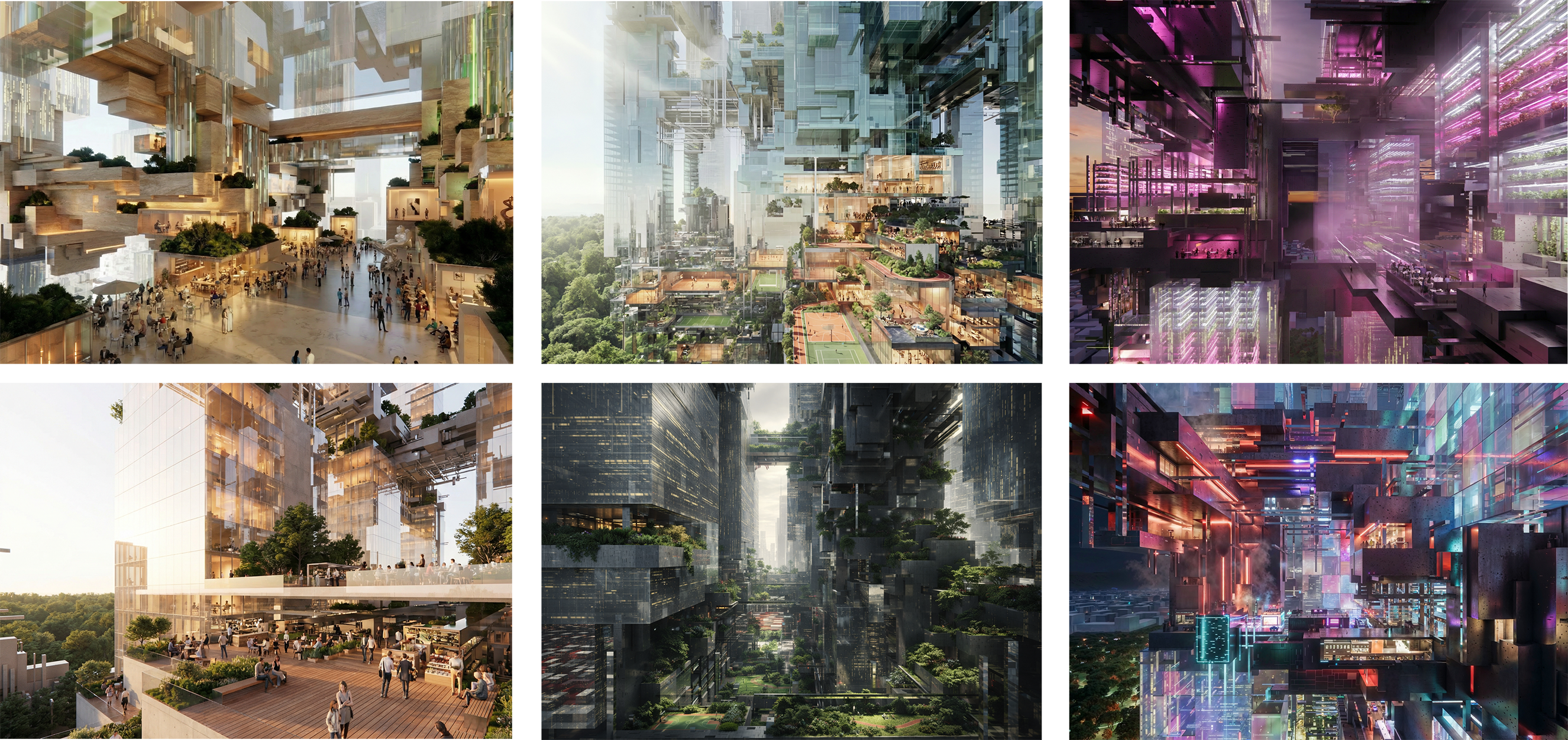
The design method reimagines the public realm as a vertically distributed network rather than a ground-bound condition, embedding civic life across multiple elevations within the urban structure. Phase 1 establishes public space as the primary organizing layer of the High-Performance City, deploying parks, retail, culture, education, offices, entertainment, and health functions throughout a three-dimensional matrix supported by structural cores.
The Neighbourhood
The neighborhood of the High-Performance City operates as a vertical village. Its character is determined by the dominant String, or by the interaction of multiple Strings, which collectively define its spatial and atmospheric logic.
The Digital Model
The shift from conventional masterplanning to high-performance urbanism is driven by the computational backbone of a digital model. This replaces static representation with a continuously updated system of real-time feedback loops. Data from society, health, governance, environment, and technical disciplines such as building services, fire safety, structure, and mobility are integrated into a single operational framework.
Parameters operate as active instruments of negotiation. Density, proximity, performance, and resilience are not predefined outcomes but continuously recalibrated conditions within the system.
The model produces a second layer of reality: a field of multi-dimensional performance analysis. Environmental simulations - of wind, thermal comfort, air quality - are coupled with human-centered metrics such as daylight and acoustics. In this way, the project is tested not as a form, but as system behavior.
The Megacity of 2050
By 2050, the world’s megacities will look radically different. The most dramatic growth will be concentrated in Asia and Africa: Cities like Lagos and Jakarta are projected to expand into some of the largest on earth, while established centers such as New York and Paris will grow far more modestly. This rapid urban expansion is bringing a convergent set of pressures: surging populations and informal settlements, strained infrastructure and mobility networks, environmental degradation and resource scarcity, deepening social inequality, and intensifying climate risks, from rising sea levels and storm surges to extreme heat. Together, these forces pose complex, interlocking challenges for sustainable development and governance, demanding design that is climate-responsive and culturally adaptive rather than one-size-fits-all.
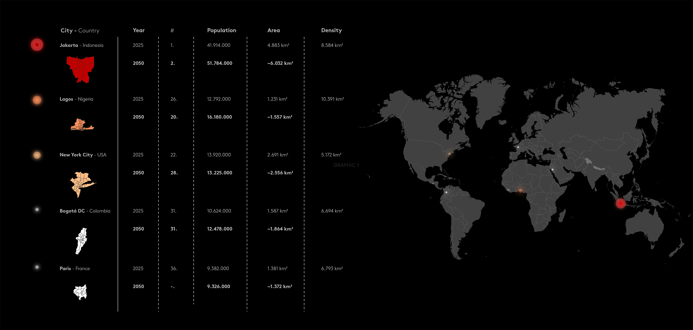
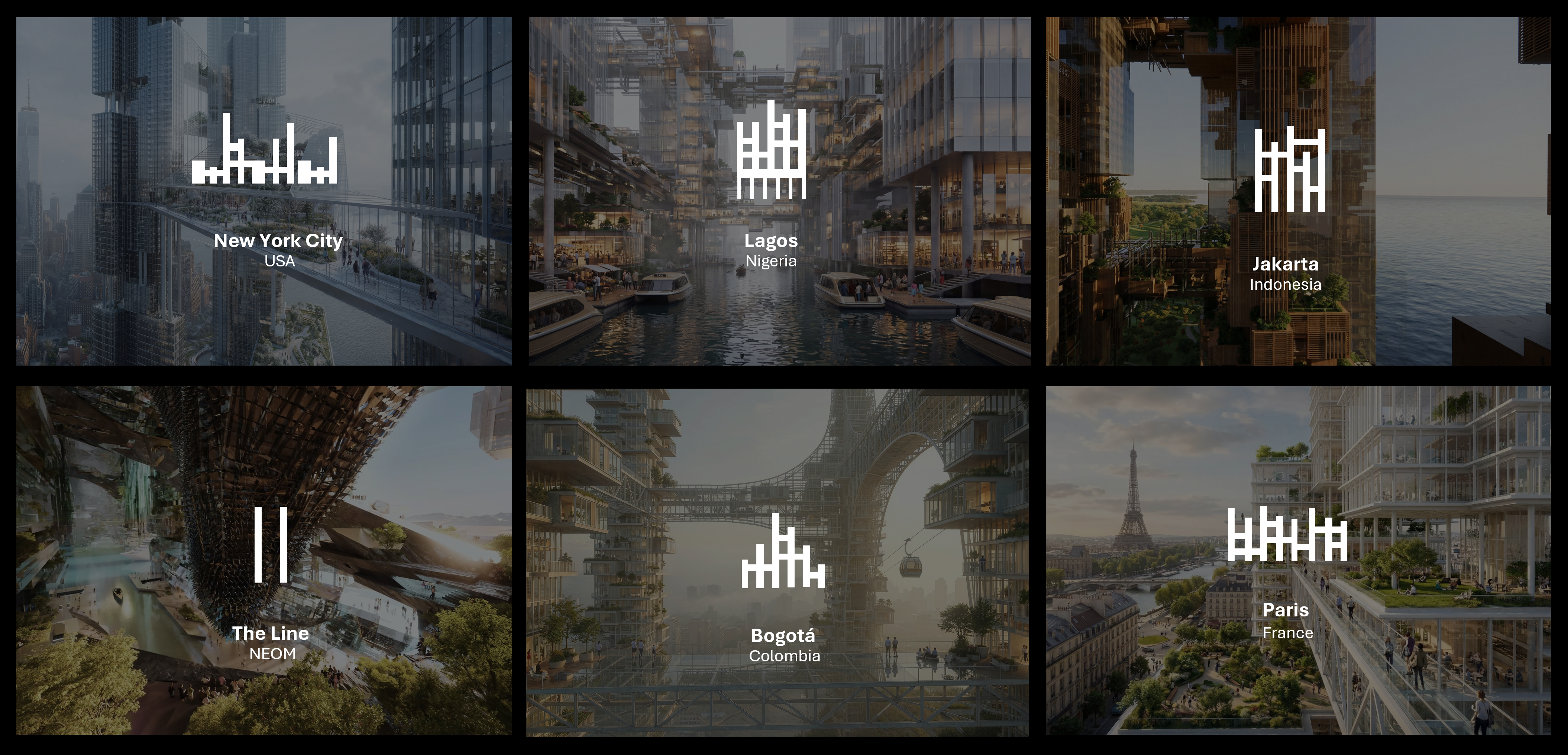
In response, we envision bringing the solution of the High-Performance City to each of these cities, adapting the same core system to the specific climate, geography, and cultural fabric of every site.
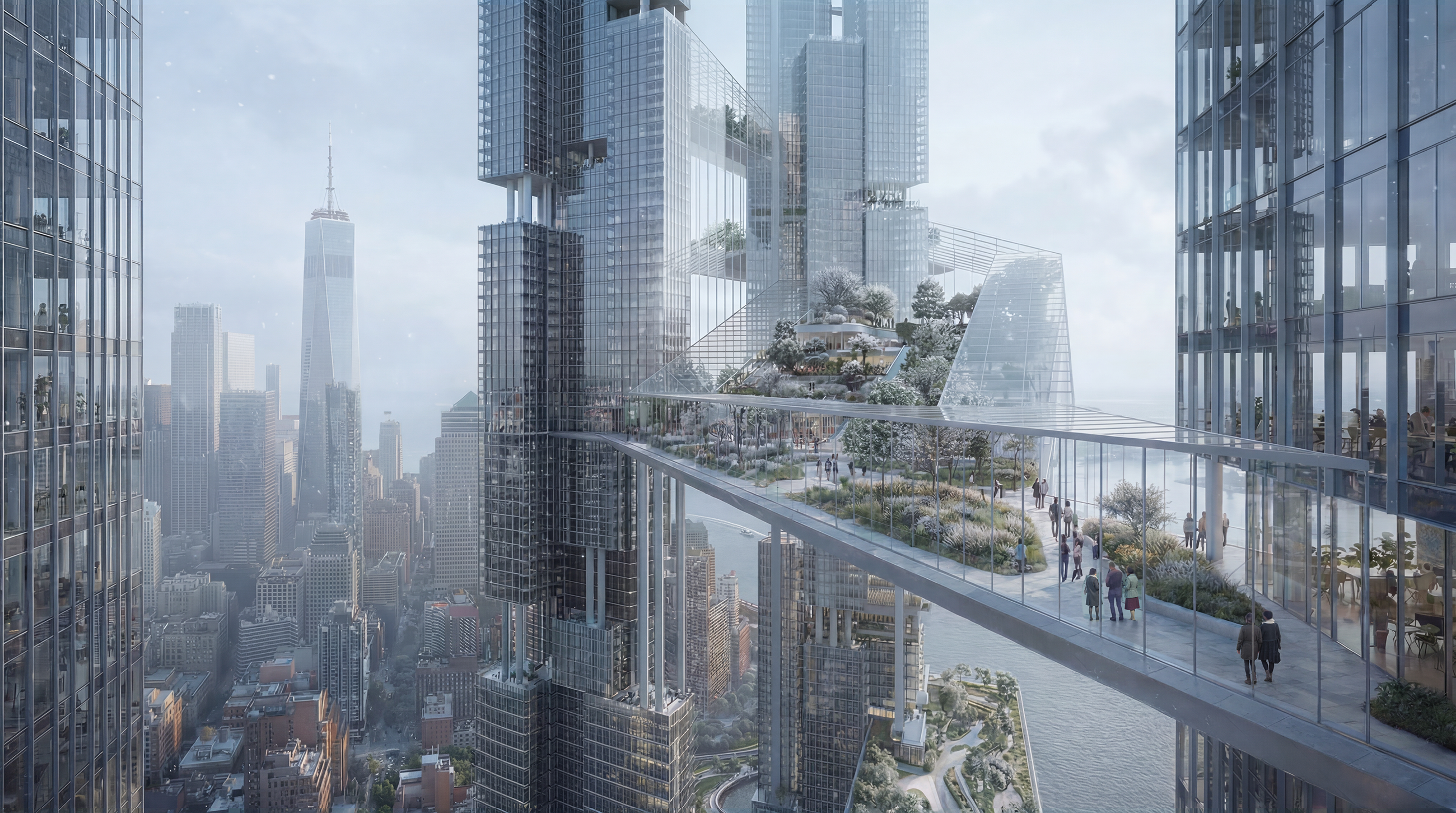
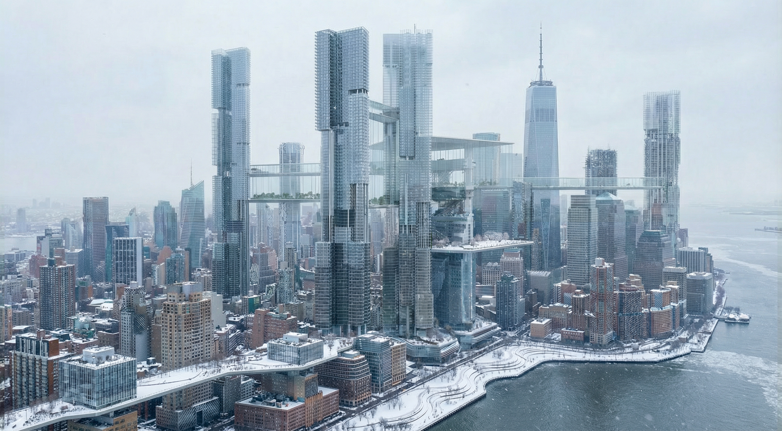
In coastal Lagos, it becomes an amphibious city lifted on piles above floodwaters; in New York, it plugs into the existing skyline as a bridged hybrid, creating new “high streets” between towers; in Jakarta, it clusters slender towers on a storm-surge-resistant plinth to absorb seismic and typhoon risk; in Neom, it turns inward as a shaded, energy-positive desert megastructure; in Bogotá, it terraces with the mountain slopes; and, in heritage-laden Paris, it weaves a low-rise, low-carbon fabric tuned to the 15-minute city. One performance-driven framework, locally calibrated everywhere, pairing vertical density with embedded biophilic green space to make each megacity denser, greener, and more livable than the sprawling model of today.
PARIS
JAKARTA
BOGOTA
LAGOS
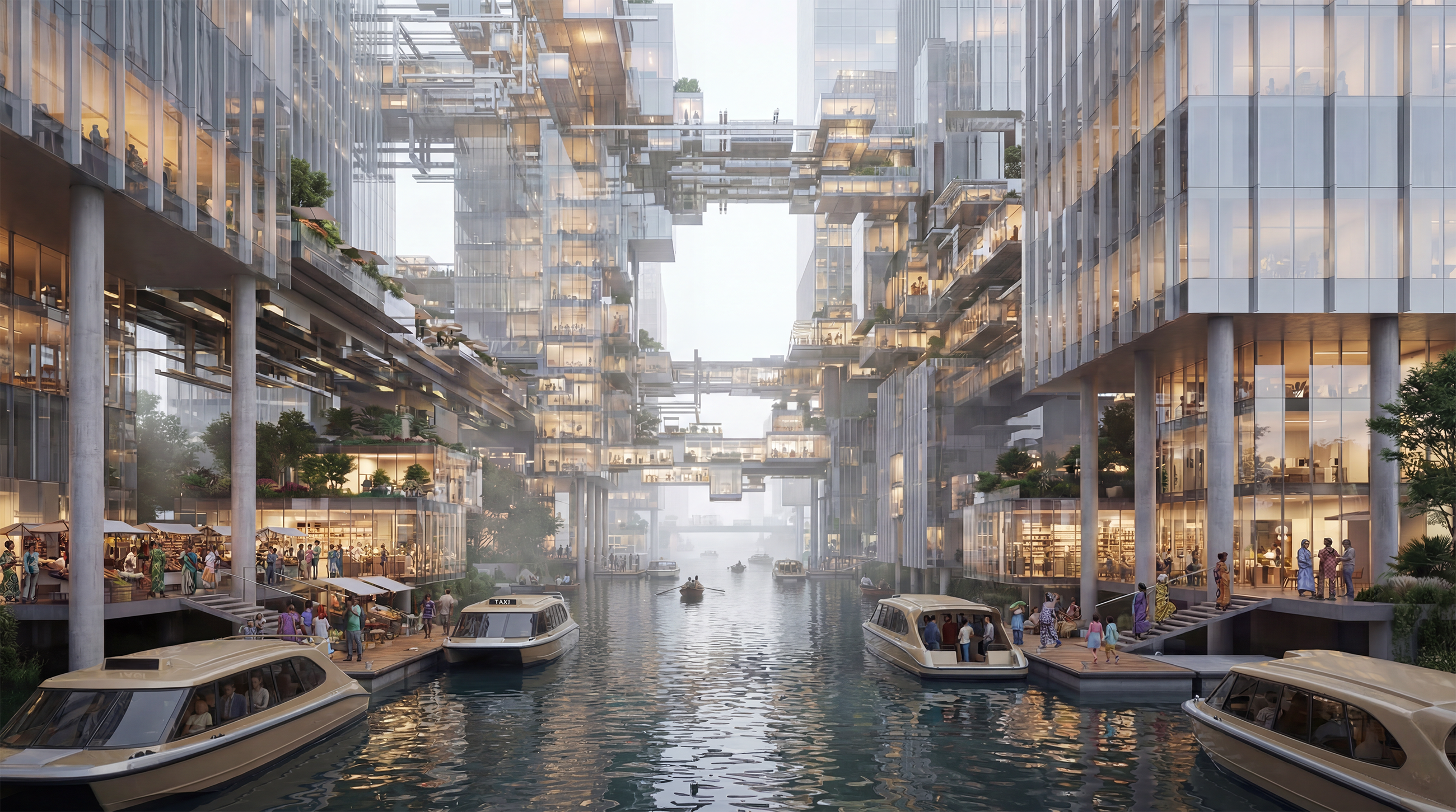
NEOM
NEW YORK
Conclusion
The central challenge of our century is clear:
Where will the next two billion people live?
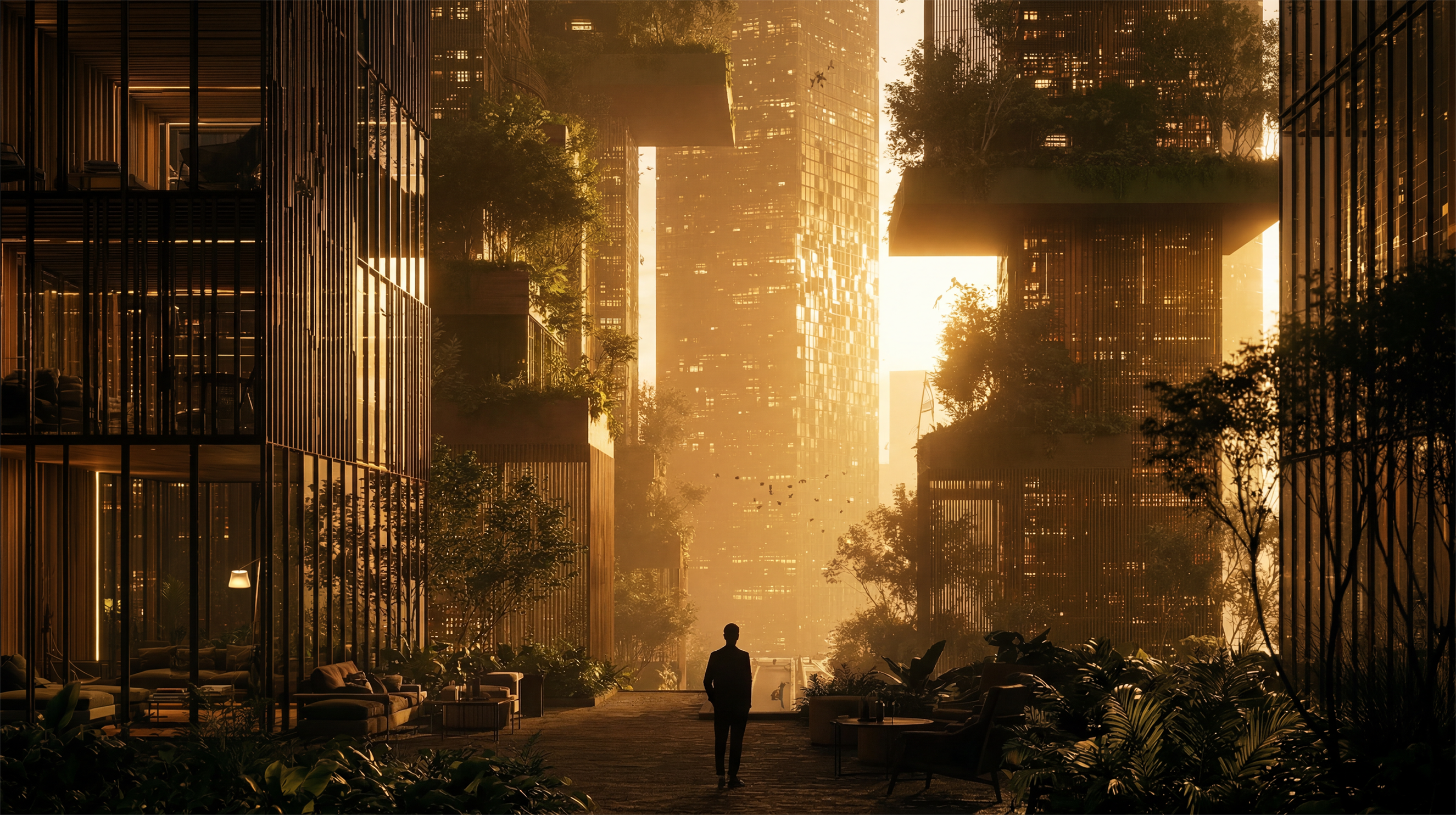
The defining challenge of our century is clear: where will the next two billion people live? As populations rise and the amount of habitable land shrinks, we cannot rely on the sprawl of the past. This project sets out a high-performance urban system that adapts to wherever it is built, powered by a living digital twin and a three-dimensional urban network.
Across diverse geographies, the mission is identical: to make density livable, to ground technology in its specific place, and to ensure that growth works in harmony with the earth. This is not a one-size-fits-all blueprint. It is a vital new way of building - a credible home for two billion people, calibrated city by city, climate by climate.
Links
1. United Nations, Department of Economic and Social Affairs, Population Division (2024)
World Population Prospects 2024 (Population Growth – Overview & 2100)
2. Global Carbon Project (2022)
Global Carbon Budget — Per Capita CO₂ Emissions (Global Greenhouse Gas Emissions – 2021)
3. Berkeley Earth
Global Temperature Data (Global Temperature Rise – 2100)
4. How We Get To Next
Mapped: The Shifting Soils of 2100 (Where Farmland Will Migrate – 2100)
5. Kulp, S.A., Strauss, B.H.
New elevation data triple estimates of global vulnerability to sea-level rise and coastal flooding. (Rising Sea Levels)
6. Gao, J., O’Neill, B.C.
Mapping global urban land for the 21st century with data-driven simulations and Shared Socioeconomic Pathways (Urban Land Area)
7. United Nations, Department of Economic and Social Affairs (2025)
World Urbanization Prospects 2025: Summary of Results (Megacities – 2050)
8. Metropolen der Zukunft
Städte der Zukunft im Vergleich (Urban Challenges)
9. Stadt Wien (2025)
Wiener Regierungsabkommen 2025: Grünräume als verlängerte Wohnzimmer und natürliche Klimaanlagen (Urban Green Spaces – Vienna)
Renderings: DMAA